Destination guide
Discover Chembra Peak
At a glance
Why this place stands out
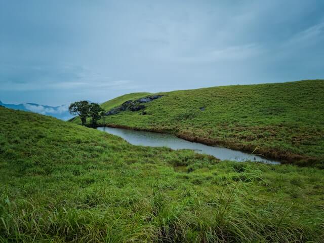
Chembra Peak near Meppadi is Wayanad's highest peak at about 2,100 metres. The regulated trek is known for Western Ghats scenery, tea plantations, broad valley views and Hridaya Thadakam, the heart-shaped lake found along the route.
Chembra Peak rises above the Meppadi region of Wayanad and is identified by DTPC Wayanad as the district's highest peak, reaching about 2,100 metres above sea level. The mountain is famous for its highland scenery: rolling tea plantations, deep valleys, grass-covered slopes and forested ridges open up along the approach. A particularly recognisable feature is Hridaya Thadakam, the heart-shaped lake seen on the trekking route and often photographed against the surrounding green slopes.
Chembra is not an unrestricted hill walk. Trekking is managed in coordination with the Forest Department, and access to higher sections can be limited when wildlife movement, weather or conservation requirements make it necessary. Visitors should therefore check the current permitted route and entry procedure before setting out.
Even when the full summit route is unavailable, the authorised trail and viewpoints make Chembra a rewarding experience for walkers and landscape photographers. Its location near Meppadi also makes it easy to combine with other Wayanad attractions in the Vythiri taluk area, including waterfalls, tea-estate scenery and viewpoints across the Western Ghats.
Nammude Keralam